Highway CA 395
The photo gallery for this report can be found here (Opens in new tab): CA 395 - September 2016 gallery
Day 1: September 4, 2016
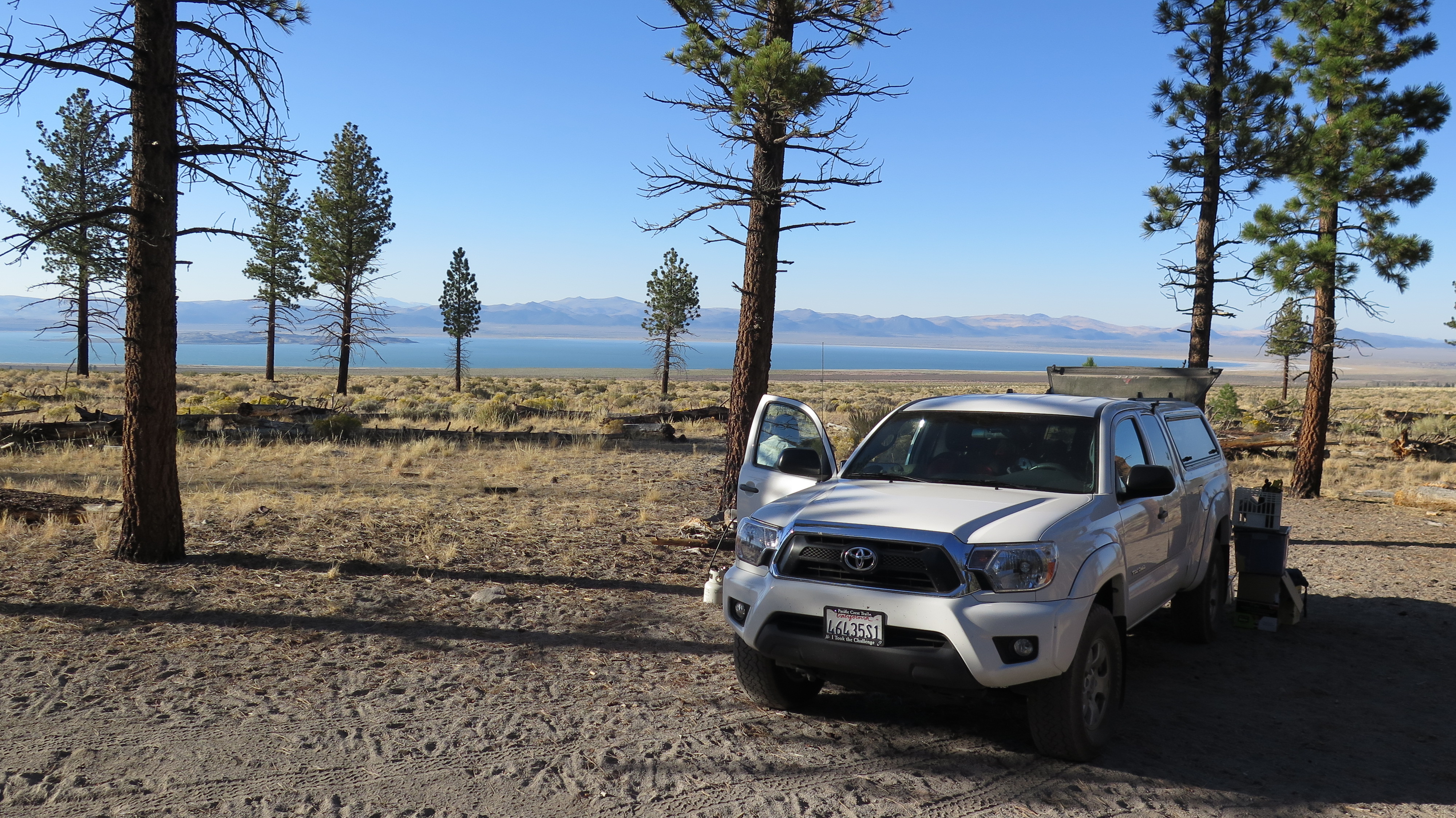
Camp above Mono Lake. (Click to enlarge)
We drove up to Bishop where we arrived at the White Mountain Information center around 1:30pm. We checked with the ranger on the permit situation for walk-in permits since we did not have any reservations. The ranger thought we should not have any problems getting permits for a given day once the Labor Day rush was over. That worked for us since we wanted to do some day hiking to acclimatize first anyway. So we continued on to Lee Vining at Mono Lake and checked with the rangers there at the Mono Lake/Yosemite visitor about the camping situation in Yosemite. We had to ask even though we didn't expect much on one of the busiest weekends of the year. The ranger confirmed that there were no camping spots available in or around Yosemite. So we asked him about some suitable dispersed camping spots on the BLM land east of Hwy 395 and south of Mono Lake. He suggested a forested area with nice views of the lake. We quickly found a good spot, prepared some dinner and crawled into our sleeping bags shortly after sunset.
Day 2: September 5, 2016
- Distance hiked: 11.3 miles
- Elevation gain: 3800 ft (GPS)
The night was quite cold and when we got up we decided against preparing breakfast at camp while freezing. Instead we headed to Lee Vining for some breakfast burritos at the gas station/restaurant on the Tioga Pass road. Once we and the truck were fueled we headed into the park. Since it was not only Labor Day, but also exceptionally good weather it came as no surprise that the park was very crowded. People were parked along the road at all the usual spots like Tuolumne meadow. It wasn't a concern for us since we had picked out a hike in an area that's not so popular.
We drove past Tenaya Lake and then headed north on small spur road towards May Lake. At the May Lake trailhead we grabbed our daypacks and headed off on the trail. After just 1.2 miles we reached the lake. There is a High Sierra Camp where one can rent bunk beds in canvas tents. Apparently there is a lottery though for the few spots available in the different camps spread throughout the park. This little hike and camping in tents by the lake seems to be very popular for families with small children, we saw lots of them. From the lake we continued on a trail north towards our goal: Tuolumne Peak. A few tenth of a mile past the lake we left the maintained trail and followed a recognizable abandoned trail. The trail started climbing up some switch backs in a little canyon with lots of juicy green growth which attracted some deer.
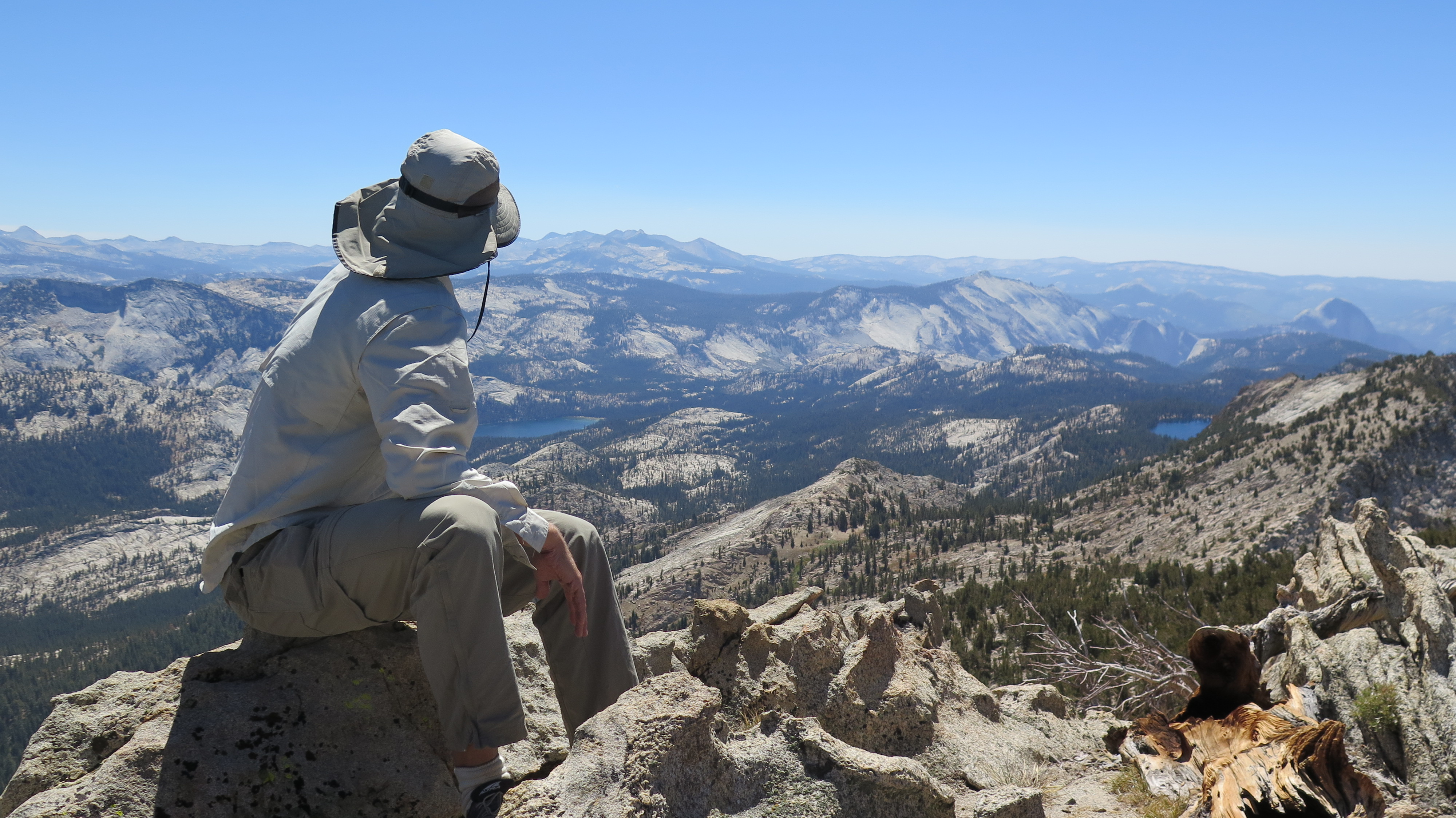
View from Tuolumne Peak. (Click to enlarge)
From the saddle we just headed straight for the peak. The route we picked loosely followed a cairned route which does not seem to be travelled, there seemed to be big gaps between cairns. Since we could see our goal and it was pretty open terrain we did not waste time looking for the marked route. The last few feet to the actual peak required some minor scrambling. The views from the top were spectacular and we marveled at the fact that we had been hiking for a few hours without meeting anyone while we knew that in the valleys below us 1000's of people were moving through the park. After a nice lunch break and some picture taking we started our return hike.
Once back at May Lake I decided to add a quick trip up to Mount Hoffmann to the hike. Srisuda opted to hang out by the lake instead. There were people on the Mount Hoffmann trail, but not too many and on the peak I actually had some time to myself. Views were of course similar to the previous peak as they are only separated by a couple of miles. After a little snack I headed back down to the lake and we hiked back to the truck.
Now it was time to look for a camping stop. Since the sign at Tuolumne meadows indicated some empty spots we drove through the campground, but where just too lake. It was probably a blessing, since the place was pretty noisy and very crowded. So we headed east on Tioga Pass road aiming for one of the many forest service campgrounds east of the park. Some of those are rather small and right next to the road which we were not too fond of. We decided then to head to Saddlebag lake where we found a nice campsite. We quickly set up camp, started a fire in the fire ring and cooked some dinner. It seemed warmer then the night before and we hung out a little by the fire drinking hot tea and eating cookies.
Day 3: September 6, 2016
- Distance hiked: 5.4 miles
- Elevation gain: 2300 ft
Initially I had planned to hike Mount Dana, the 2nd highest peak in Yosemite, but looking at it and how barren it is I changed my mind. One reason we go up there to the Sierra is to get some green and water. Instead of that hike we headed back towards Bishop to see if we could get some permits for Bishop pass. We arrived at the ranger station just after 10am and were able to get a permit for the same day. So we headed straight out to South Lake, found a spot in the hiker's parking lot and packed our backpacks. Around 1:30pm we started hiking towards Bishop pass. As we were entering the wilderness a couple came out after a 25 day / 180 mile adventure starting from Bridgeport in the north.
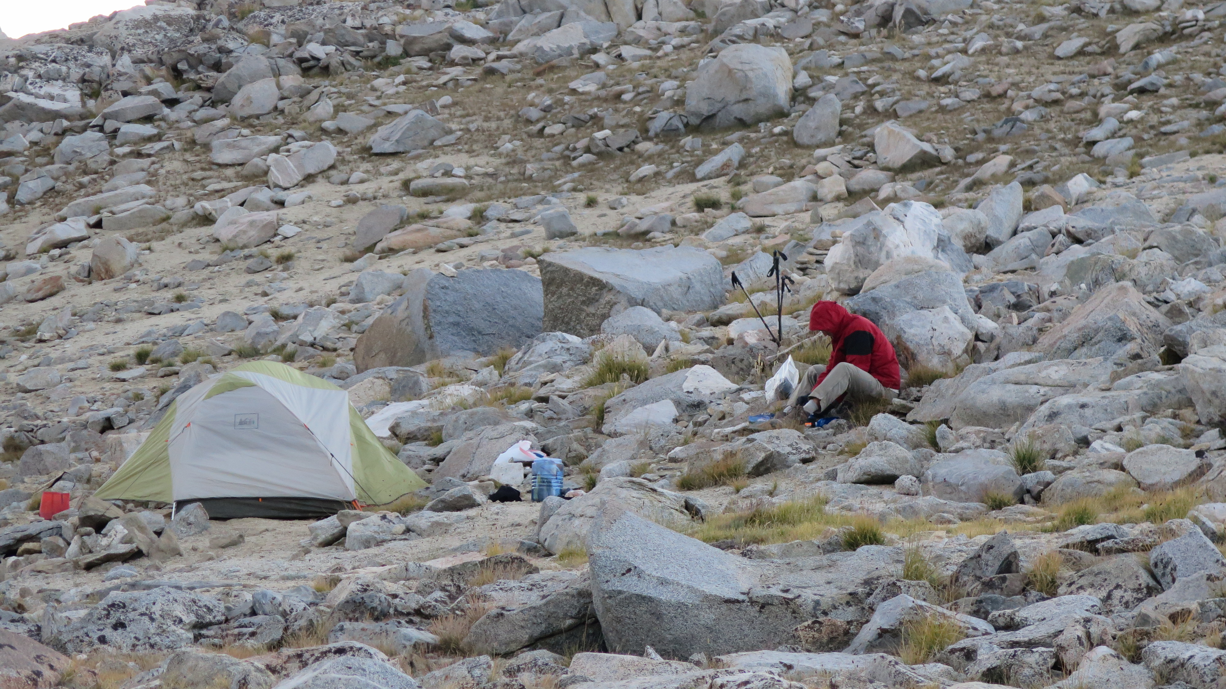
Preparing dinner at Bishop Pass camp. (Click to enlarge)
We got into a nice hiking rhythm and soon reached Long Lake where we found a nice rock in the shade to sit on and have our lunch. As we were sitting there a hiker came by and commented on the nice spot we picked. We started to chat and it turned out he knew the area well. I quizzed him on the camping spots at Bishop lake below the pass or opportunities on the pass itself. He said there were a few good spots on the pass close to the little lake up there. So given the calm weather and weather outlook we decided to head all the way to the pass. This would allow me to start my scramble up Mount Agassiz (13'893 ft) in the morning without having to pack up the tent and it would give Srisuda a nice base to hang out while I was gone. As we hiked on we ran into the same hiker and started chatting some more. Turns out he was on his way to solo climb (with rope) the last 14er in California that he had not been on. Quite impressive for a 70 year old climber/hiker! We also met a girl who had just been up Mt. Agassiz as a day hike and I was able to get some last minute info about the scramble. We reached the pass around 5pm, found a nice spot that someone had cleared of rocks and level, setup camp, cooked dinner and crawled into our bags as it got quickly cooler when the evening breeze started.
Day 4: September 7, 2016
- Distance hiked: 1.9 miles
- Elevation gain: 1900 ft
- Distance hiked: 1.3 miles
- Elevation loss: 700 ft
After a good night's sleep through a windless night I got up, prepared some oat meal and was off to get to the top of Mt. Agassiz by about 7:15am. I headed for the steep mountain in front of us ready to climb the 2000 ft to the top. Going for what looked like the most obvious route I found some cairns and use trail climbing up past a snow field on the northwest slope. The climb quickly turned into negotiating good size boulders. The cairns were hard to follow and I decided to just find my own way. I made decent time and was up on the peak in a little over 2 hours. Up there I took in the great views, snapped some pics and had a nice snack. Then I essentially followed the same route down that I had come up.
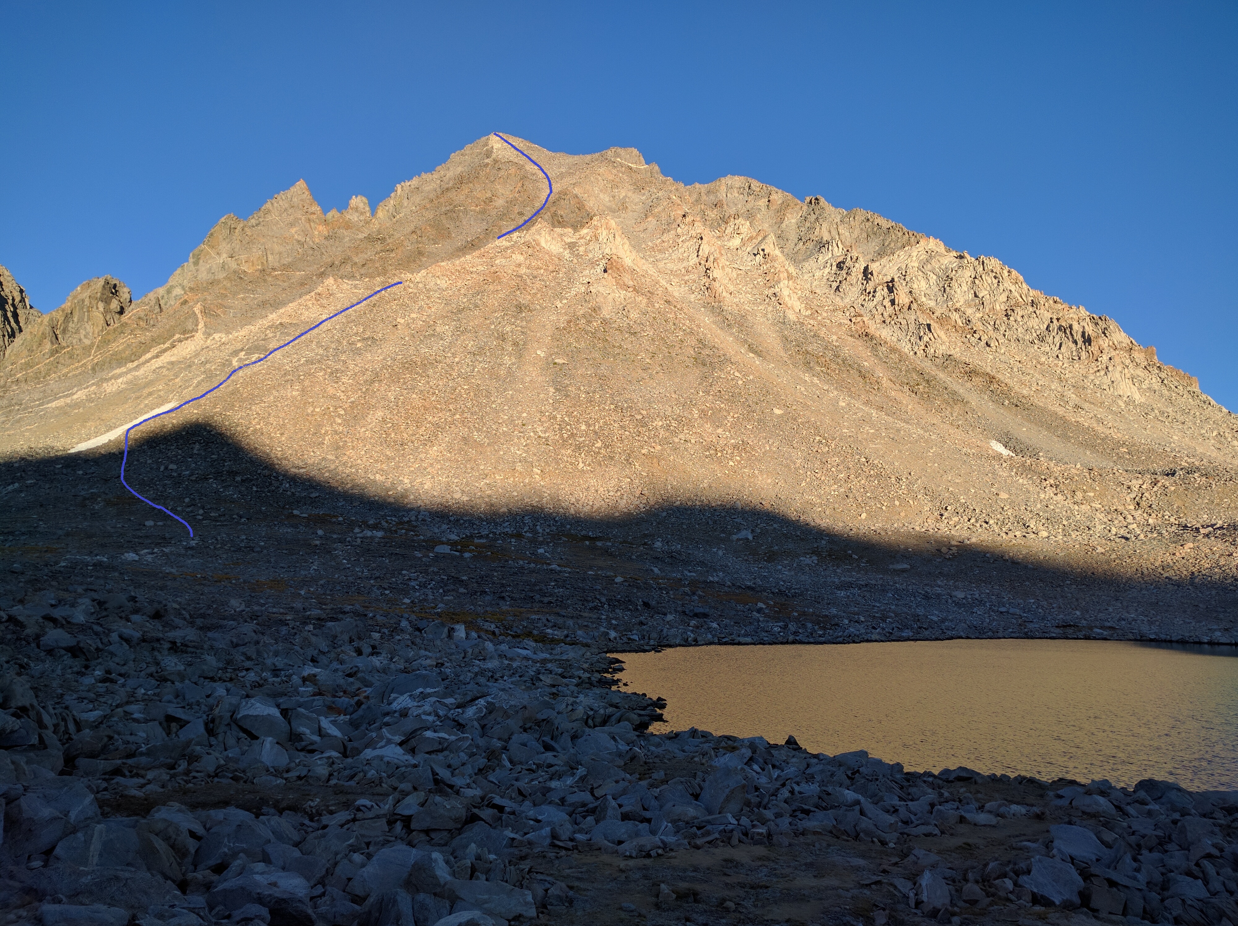
Approx. route up Mt. Agassiz (Click to enlarge)
Back at camp before noon we prepared some lunch before packing up camp and heading down the path towards Dusy Basin. Once down at the lakes we found a nice camp site and settled in for a lazy afternoon taking in the views. A couple of hours before sunset more people arrived and about 4 other groups settled around the big lake. These lakes, like most lakes close to major trails in the Sierra, are very popular overnight spots for backpacking. Apparently the basin is also known for lots of bugs and in the spring and summer hanging out without a mosquito net is no fun. We did not get bothered at all sitting there on the rocks and enjoying the changing light on the mountains in front of us.
Day 5: September 8, 2016
- Distance hiked: 6.7 miles
- Elevation gain: 700 ft
After a pleasant night we got up to another calm morning and prepared breakfast. The tent had a little ice on it, but we had a very comfortable night inside. We watched the sun come up over the Middle Palisades before starting our climb back up to Bishop Pass. We meet more hikers along the way and started to feel a little out of place with our 2 night outing since everyone seemed to be out for 10 days or more. Including a 2 couples how told us that they were 70 years old and out for a 2 week backpacking hike. We got to the truck just after noon, retrieved our food items from the bear storage at the parking lot and headed down to Bishop. Our next goal was to get permits for an overnight hike starting the next day up the Big Pine North Fork Creek.
Unfortunately there were no permits available for the Friday, but would we want to hike our today? Well, we hadn't planned it, but ok. So we got permits for the same day thinking we would hike in a mile or so and just set up camp. But first we had to get a shower and some food. The Wash Tub Laundromat in Bishop offers showers for $5, so we went. After getting cleaned up we headed to a burger place and had some big burgers with fries. At the same time we took inventory of our food supply for the hike and made a short list of items we needed. Once at Vons to fill the list I noticed the donuts.. We were going to hike again, so what ?
- Distance hiked: 4.7 miles
- Elevation gain: 2350 ft
Around 4pm we left Bishop for the Big Pine Creek trailhead. Hiker parking is about a mile down the road from the trailhead, so I dropped Srisuda and the packs at the trailhead before parking the truck. We finally hit the trail at 5:40pm, leaving us with about 2h of usable daylight. We decided to hike for 1.5h and then use the rest of the day light to make camp. Temperatures were comfortable and we enjoyed walking. We got past Second Falls into a flatter, forested area and saw a nice camp spot around the time we had planned to camp. However, Srisuda had been using caffeinated Gu shots and had all kinds of energy. She suggested to just chance it and keep on going for a while in the dark with head lamps. By around 9pm we finally looked for and found a camp spot. Camp was quickly set and a big pot of noodles cooked.
Day 6: September 9, 2016
- Distance hiked: 8.7 miles
- Elevation gain: 3900 ft
It turned out that we had made it to Second lake. After just some coffee we started hiking again aiming for Forth Lake. We soon got there and found a very nice site overlooking the lake. After setting up the camp and having some food I set off for Cloudripper (13'525ft) another 13er I wanted to climb.
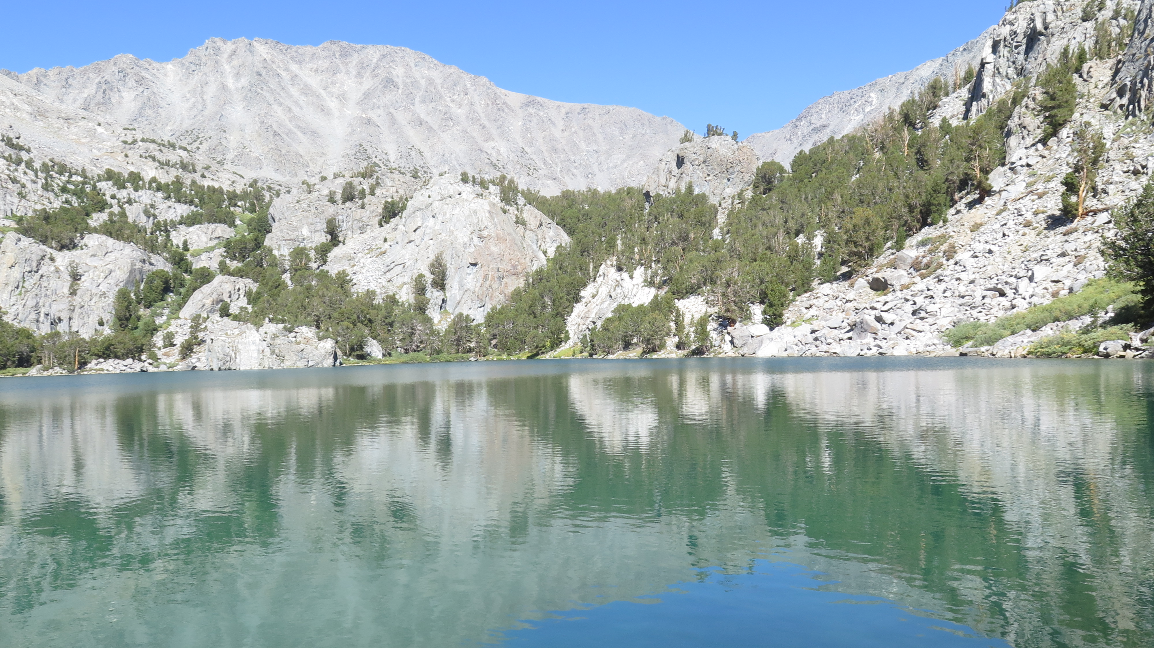
Cloudripper from 5th Lake. (Click to enlarge)
I followed the trials to Sixth Lake and then some cairns on to Seventh Lake. It did not appear as if many people make it that far back. From the last lake I headed north to scramble up some very loose scree to a ridge at about 12'300ft that then would lead me to the saddle between Cloudripper and Vagabond at around 13'000ft. The climb was no fun in this 2-steps-forward-1-step-back type of terrain. The scramble up the ridge was much more fun since it was on more solid ground. From the saddle I climbed big rocks up to the peak. The peak ridge is very rugged with lots of huge boulders. I made it to the summit block but did not see a good way to the very top of it and so called it close enough. I found a nice rock to have my lunch break. Checking my supplies and the time I decided I had enough time to also climb Vagabond (maps only show the elevation for this peak, 13'374ft). Up there I was visited by a weasel while having my snack. It was a very calm day even at this elevation and I took in the views for a while before heading back to camp. Another weasel crossed my path on the way down.
Back at camp I caught up with Srisuda who had explored around the lakes and chatted we a number of the other campers in the area. We cooked dinner and enjoyed a nice evening by the lake.
Day 7: September 10, 2016
- Distance hiked: 6.2 miles
Time to go home. We just had some coffee before heading back out to the trail head. Along the way we stopped for pictures at the lakes we had passed in the dark on our way up. We got back to the trail head by noon and checked at the Glacier Lodge if they offered showers, they did and we took advantage of yet another set of $5 showers. Then it was down the mountain. We were hungry by now and decided to continue our tradition of having the exit meal at the Whitney Restaurant in Lone Pine. After lunch we got back on Hwy 395 and headed home. Another great late Summer trip to the Sierras!