Highway CA 395
The photo gallery for this report can be found here (Opens in new tab): CA 395 - September 2015 gallery
Day 1: September 11, 2015
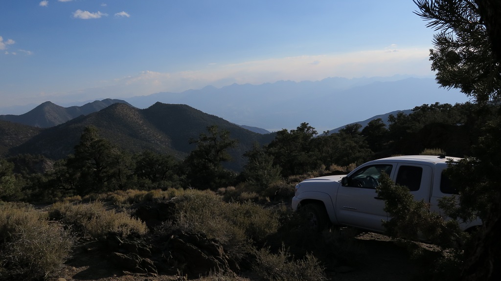
Sierra Nevada from camp on Grand View Mine Rd. (Click to enlarge)
We drove up to Lone Pine where we stopped at the visitor center to see if there was any important information about the areas we planned to visit. After a quick chat with a ranger we continued up to Big Pine where we turned east to head into the White Mountains. Our destination for the day was the Grand View Campground. When we arrived there we found that only a couple of sites were available. This was due to an amateur astronomer club meeting at the camp ground. There were some impressive telescopes set up around half of the sites. We occupied a site and went for a little walk towards a hill at the western end of the campground. We wanted to see the Sierra Nevada panorama and despite the name of the campground there are no views. We walked along the road to the Grand View mine and once on the hill noticed that there were camping opportunities on the road to the mine. So we turned around and got the truck to relocate our camp. The spot we picked looked like it gets used a lot and the views were great, though a little obscured by the smoke from the huge fires burning on the western side of the Sierra.
Day 2: September 12, 2015
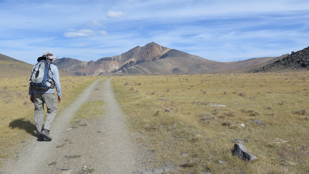
Along the road to White Mountain Peak. (Click to enlarge)
After breakfast, during which we watched the sun light up the Sierra, we headed out for our first hike of this trip. The goal was to hike White Mountain Peak, at 14,252 ft (4344 m) California's 3rd highest peak. For the first few miles the road to the trail head is paved until it reaches the Bristlecone forest visitor center. The remainder of the 18 miles from the campground to the parking area for the hike is a well maintained dirt road passable by regular passenger cars. The drive terminates at a locked gate. The road continues for to miles to the Barcroft research station and even all the way to the peak. From the research station to the peak it becomes more of a 4x4 road tough.
- Distance hiked: 15 miles
- Elevation gain: 3600 ft (GPS)
Just as we started to hike a convoy of 6 full-size vans loaded with graduate students in Ecology from the University of Davis arrived. They were part of our hike all the way as they spread out along the trail. The hike was quite uneventful as it follows the old road and traverses the desolate, dry landscape. On the peak we had a nice break enjoying the views before heading back. Just before reaching the research station again I took of cross-country to hike over the top of Mt. Barcroft. We then reunited at the truck and headed back for camp.
When we arrived at camp it was very windy, exposing a disadvantage of the site with great views. Passing through the camp ground we had noticed that there where some empty sites and so we decided to relocate. After a nice dinner we quickly went to bed to rest after the days exertion. Hiking 15 miles above 11,000ft just a day after arriving from sea level takes some energy.
Day 3: September 13, 2015
For this day we had planned to just pick up our backpacking permit for a 2 night backpack hike up to Bishop Pass and then head to the campground in the trees at Glacier Lodge above Big Pine. We enjoyed that spot last year and picked it as a nice place to spent a rest day. Well, it did not work out that way. As we were driving down from the White Mountains we saw a lot of haze over Bishop. When we got to the Bishop Ranger Station it was confirmed that this was due to the smoke from the Sierra fires. As we went through the permit pick up process the ranger advised us to take face masks on the hike in case the smoke got really bad. This made us wonder about the idea of hiking in the area. So we headed up to the trail head to check out the situation and to maybe talk to some hikers coming off the trail.
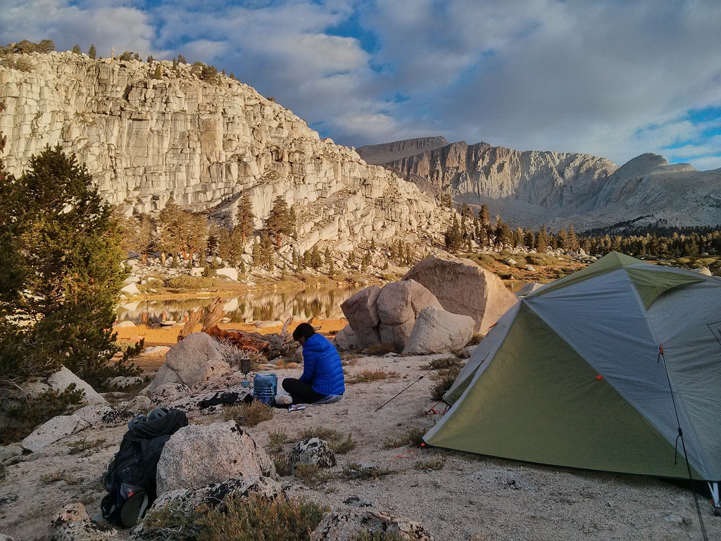
Preparing breakfast at Cottonwood Lake camp. (Click to enlarge)
Once at the trail head we got out of the truck at a picnic area and immediately smelled smoke. We caught some hikers who had spent a few days in the area we planned to visit and they said they encountered some smoke, but it would clear for some time during the day. This did not sound too appealing. In addition we learned that road construction at the trail head would require us to park a mile down the road and that there was no trail to avoid a mile long road hike. It did not take us long to decide these were not the conditions for which we came to the mountains. We headed back to the ranger station to see if they had any better options.
This time we talked to a different ranger and he suggested the Cottonwood Lakes area since he had had reports of smoke all along the Inyo forest further north. We just went to those lakes last year and really wanted something new, but we also wanted clear mountain air. There were permits available for the same day. After a short deliberation we decided to take a permit for the same day even though that meant 3 nights on trail rather than 2. We'd just hike in a couple of miles on the first day.
- Distance hiked: 5.5 miles
- Elevation gain: 1200 ft
With the new permit in hand we went to Smart & Final to buy a new block of ice for our ice box and then went to McDonalds for a snack since they have free WiFi and I wanted to do a little research on what new things we could do in the Cottonwood Lakes area. After some browsing I came up with a plan and we headed south to Lone Pine and then up to Horseshoe Meadow. Once at the overnight parking area we spread our gear on the ground and packed our overnight backpacks. We also consolidated all our food items from the truck in boxed and then put these and the ice box in the food lockers at the parking lot. All this took some time and we were ready to hike at 4:15pm. We weight our packs which came in at 27 and 47 lb. A chance for snow was forecast so we had to carry some extra clothes.
It was cool and there a bit overcast which made for perfect hiking conditions. We quickly settled into a good pace and made much better progress than I would have expected. It looked like we could make it all the way to the first lakes before dark. Once I mentioned that Srisuda actually picked up the pace. We arrived just before sunset and quickly set up the tent since there were some ominous clouds in the sky. Good thing we did. It started to rain just when we were ready to cook dinner. Fortunately it was just a 30 min long shower and we had the tent as shelter.
Day 4: September 14, 2015
- Distance hiked: 6.5 miles
- Elevation gain: 1200 ft
After taking some pictures of the area in the early morning light we prepared some hot coffee and breakfast. While breaking up camp the marmots came out and watched us from the rocks nearby. No doubt hoping we'd leave something behind for them. Of course we had to disappoint them. Once everything was packed we headed up New Army Pass.
View west from New Army Pass. (Click to enlarge)
It was overcast with some wind, so the climb up the pass was in nice cool conditions. Once on top we where hit by a brisk cold wind and we had to put some extra cloth on. There were also quick moving clouds with a ceiling just below 13,000ft. We did not spent much time up there and instead started heading down on the west side of the pass. Our destination for the day was Soldier Lake. By the time we reached the tree line conditions were comfortable again and we took the jackets off. It was just a little over a mile to the lake now. There was quite some traffic on the trail, mostly people heading out after a weekend in the wilderness.
We reached Soldier Lake just after noon, picked a camp site (we were the only ones there, more people arrived later) and set up our tent. We decided to take a little nap before exploring around the lake and maybe some nearby lakes. It did not take long, however, before it started to rain. The rain did not stop all afternoon and so we got a lot of rest in the tent. That's when the Kindle came in handy. Around dinner time we found a relatively dry spot under some trees where we could prepare our dinner. It rained on and off all night and we were wondering whether we would be able to do our day hike the next day.
Day 5: September 15, 2015
- Distance hiked: 7 miles
- Elevation gain: 3200 ft
At first light it was still raining, so we delayed getting out of the tent a little bit. When it stopped we got out and prepared breakfast. While not clear, the sky looked a bit more benign then the afternoon before and so we decided to go with our original plan adjusted for the time lost due to the later start.
We headed around the lake, then over a little ridge and down to Rock Creek. On the other side we went up to Erin Lake. From here I wanted to try to climb Mt. Pickering and Mt. Joe Devel. Given that we were a little late I scaled that back to only Mr. Pickering. Srisuda was going to hand out a the lake to rest and take pictures.
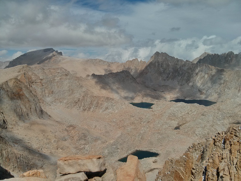
Mt. Whitney from Mt. Pickering with Blue Sky Lake. (Click to enlarge)
At 11am I took off trying to find a route out of the bowl around Erin Lake. Since I only had some short time to research that area during our McDonalds stop I did not have very good information about routes. The only one I had found turned out to go over some terrain and up some walls I did not feel entirely comfortable with going out by myself. So I studied the topo map a little more I came up with a possible route. I found a nice chute leading up to a plateau from where I could walk up to the base of the final rise of the mountain. The chute was steep and had some very loose rocks in it and it was clear that this would not be much fun coming down. The remainder of the ascent was very straight forward. With the bottom portion above the plateau being very sandy and the top very rocky. Views from the top were spectacular and I took a nice break fuelling a little while enjoying the panorama. On the way down I had to consult my GPS to find the chute again after not finding the key cairn I had placed to find it. As expected the chute was not much fun and I proceeded very slowly making sure not to dislodge any rocks that could hurt me. I arrive back at the lake 4h after I had left.
We retraced our tracks from Erin lake to camp with a stop at Rock Creek to filter water. After another strenuous day we had dinner, eating most of our remaining food, and soon settle in for a good night's sleep. It was cold on this cloudless evening with some wind.
Day 7: September 16, 2015
- Distance hiked: 10.5 miles
- Elevation gain: 1000 ft
Time to hike out and head home. We opted to hike out via Cottonwood Pass rather than the way we had come in. This route has a little less elevation gain, but it also is much drier than over New Army pass. There is only one reliable water source which is Chicken Spring Lake just west of the pass. From camp we hike a little over half a mile to the creek coming down from Army Pass. Here we filter water for the remainder of the hike. There was frost on the meadow by the creek.
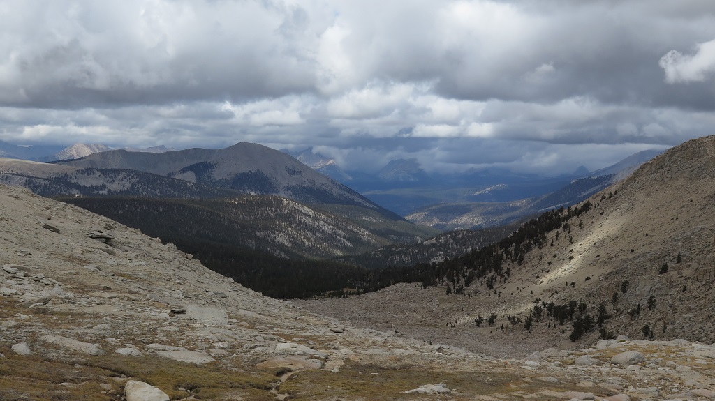
Telescope Peak way back in the distance. (Click to enlarge)
On the hike we met a few people coming in. It's always interesting to see how many people hike solo. Just above Chicken Spring Lake we took a nice break eating our last crackers. Looking west we could see Telescope Peak which we had climbed just a few month ago.
We got back to the truck by about 2pm, retrieved our food from the bear lockers and drove down to Lone Pine for a nice big burger lunch at the Whitney Restaurant. After that we hit the road to arrive at home around 8:30pm. It was a great outing and we can't wait to do it again.